Contents
The Annapurna Base Camp trek walks you straight into a natural amphitheater ringed by peaks over 7,000 meters, ending at a base camp perched at roughly 4,130 meters. Before you book, we aims to help you see how the route actually moves, because the trail rarely climbs in a straight line and the starting point shifts depending on road access and your chosen itinerary.
This page is your route-first guide. We map the sequence, the key villages, the daily distances, and the elevation swings so you can picture the whole journey before your boots ever touch the trail.
Annapurna Base Camp Trek Route at a Glance
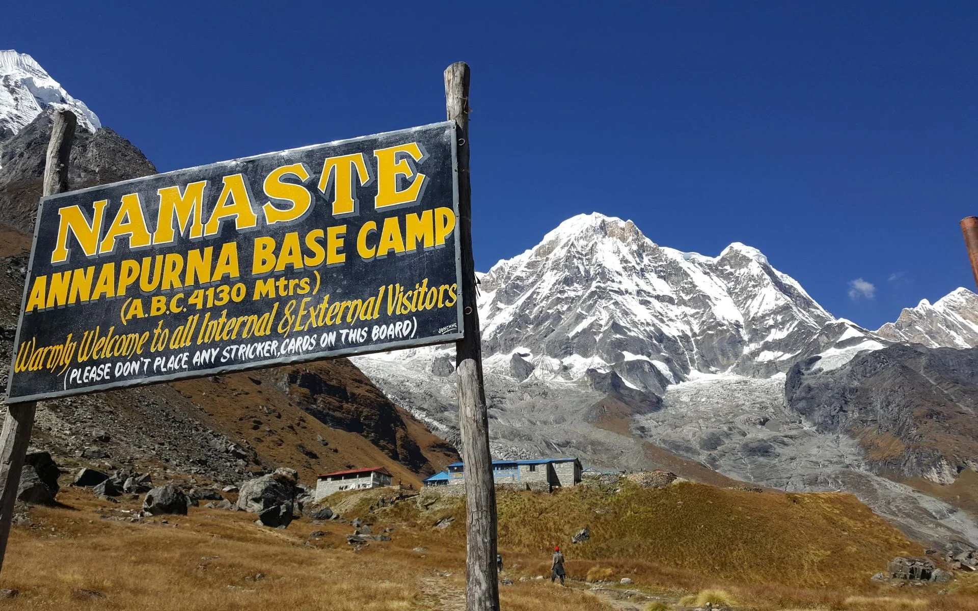
The ABC route runs from Pokhara into the Annapurna Sanctuary, climbing through terraced villages and forest before entering a steep glacial gorge that opens at base camp. The classic sequence is Pokhara to a trailhead, then Ghandruk or Kimche, Chhomrong, Bamboo, Deurali, Machapuchare Base Camp, and finally Annapurna Base Camp before retracing back.
A simplified route logic looks like this:
Pokhara (820m) → road transfer to trailhead
Trailhead → Ghandruk / Kimche region (around 1,940m)
Chhomrong (2,170m) — the gateway village
Bamboo (2,310m) → Deurali (3,230m)
Machapuchare Base Camp (MBC) (3,700m)
Annapurna Base Camp (ABC) (4,130m)
Return via the same corridor, often with a stop at Jhinu Danda hot springs
Because ABC itineraries vary, treat this as the route framework rather than a fixed script. The valley uses one main corridor, so almost every version funnels through Chhomrong and Deurali.
Annapurna Base Camp Trek Map: What It Shows
A useful ABC map does more than mark a line. It shows the road transfer from Pokhara, the trailhead, the descent-and-climb around Chhomrong, the narrowing sanctuary gorge above Bamboo, and the two base camps at the head of the valley. It should also mark the return route, which typically mirrors the inbound path.
The single most important thing a map reveals is that the trail is not a continuous climb. You drop into the Chhomrong Khola valley and climb back out, then follow the Modi Khola gorge upward. Reading these dips helps you plan realistic daily distances and understand why some short days feel harder than long ones.
Annapurna Base Camp Trek Route: Major Stops
Here is how the key points on the map connect, moving up the valley toward base camp.
Starting Point (Trailhead)
Trekkers begin with a road transfer from Pokhara (820m) to a trailhead such as Nayapul, Kimche, or Jhinu Danda. Jeep roads now reach deep into the lower valley, so your exact start point depends on the itinerary and current road conditions. Shorter packages drive higher to save a day.
Ghandruk
Ghandruk (around 1,940m) is a large Gurung village with stone houses and wide mountain views. Many itineraries route through here for the culture and the first clear look at Annapurna South and Machapuchare. It's a common overnight on the inbound or return leg.
Chhomrong
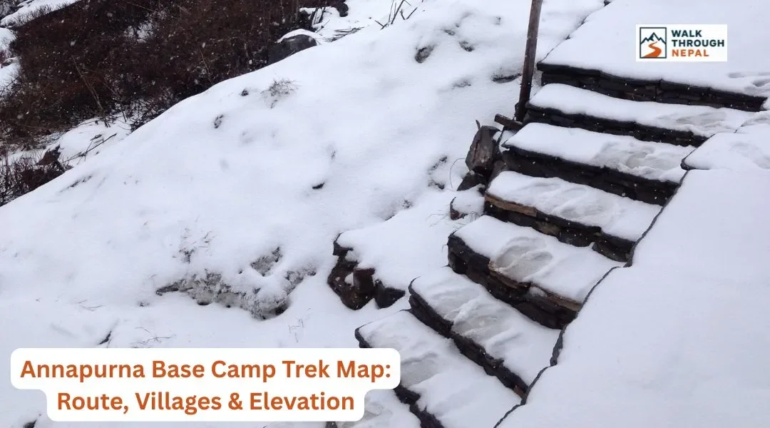
Chhomrong (2,170m) is the true gateway to the sanctuary and the last permanent settlement of its size. Every trekker passes through it. The village sits on a steep slope, and the trail here involves a long stone-step descent to the river before climbing again, which many trekkers underestimate.
Bamboo
Bamboo (2,310m) sits inside dense, humid forest along the Modi Khola. From here the route stops passing farm villages and becomes a string of trekking lodges built for the sanctuary trail. The terrain turns wetter, mossy, and more enclosed.
Deurali
Deurali (3,230m) is where elevation starts to matter. You've crossed above 3,000 meters, the air thins, and the gorge narrows into avalanche-prone terrain. Guides watch conditions closely on the stretch between Deurali and MBC, especially in early spring and after fresh snow.
Machapuchare Base Camp (MBC)
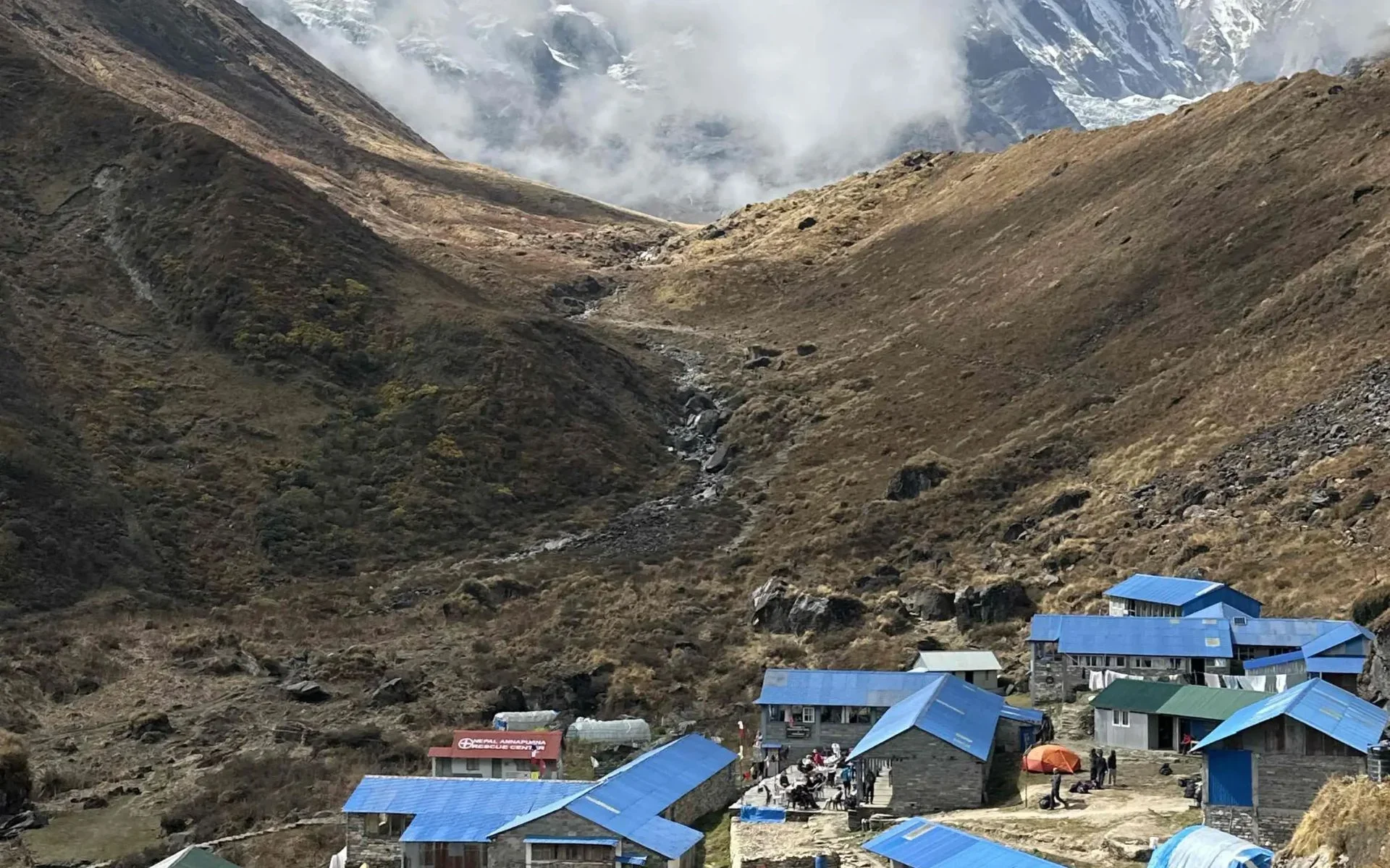
MBC (3,700m) is the critical acclimatization and transition point. The valley suddenly opens, and you're surrounded by the sacred fishtail peak of Machapuchare. Many trekkers sleep here to help their bodies adjust before the final push.
Annapurna Base Camp (ABC)
ABC (4,130m) is the destination — a flat pocket of lodges encircled by a 360-degree wall of peaks including Annapurna I, the world's tenth-highest mountain. Sunrise here, with alpenglow hitting the summits, is why people make the journey.
Annapurna Base Camp Trek Route by Day
Below is a representative -day route that respects safe acclimatization. Distances and elevations are approximate and vary by trailhead and package. Always confirm your operator's exact daily plan.
Day | Route | Approx. Distance | Sleep Elevation | Highlight |
1 | Arrival in Kathmandu |
| 1,400m | Arrival & rest |
2 | Kathmandu → Pokhara | ~200 km drive/fly | 820m | Lakeside City |
3 | Pokhara → Trailhead → Ghandruk | ~10 km walk | 1940m | Gurung village views |
4 | Ghandruk → Chhomrong | ~11 km | 2,170m | Sanctuary gateway |
5 | Chhomrong → Bamboo | ~9 km | 2,310m | River gorge forest |
6 | Bamboo → Deurali | ~10 km | 3,230m | Alpine transition |
7 | Deurali → MBC → ABC | ~8 km | 4,130m | Base camp sunrise |
8 | ABC → Bamboo | ~15 km | 2,310m | Fast descent |
9 | Bamboo → Jhinu Danda → Pokhara | ~12 km + drive | 820m | Hot springs finish |
Note the ascent on Day 6 gains height from Deurali. If your body feels the altitude, splitting this into a night at MBC keeps you within safe limits — sleep elevation should not rise more than 300 to 500 meters per day above 3,000 meters. For more on this, read our Annapurna Base Camp trek altitude guide.
Annapurna Base Camp Trek Elevation Profile
The ABC elevation profile is not a smooth ramp. The trail climbs from Pokhara's 820m, dips repeatedly around Chhomrong, then rises steadily from Bamboo through Deurali to base camp at 4,130m. The biggest single-day gain sits between Deurali and ABC, which is where altitude awareness matters most.
Understanding the profile explains why the trek feels harder than the raw elevation suggests: you climb far more total vertical meters than the start-to-finish difference because of the ups and downs. For the full breakdown of every stage and acclimatization advice, see our dedicated altitude guide.
How Long Is the Annapurna Base Camp Trek?
Most ABC treks take 7 to 12 days of trekking, covering roughly 70 to 115 kilometers round trip. The range is wide because road access changes the starting point — driving higher into the valley can cut one or two full walking days. Weather delays and acclimatization needs can also stretch the timeline.
For a realistic sense of daily effort and terrain, pair this route map with our ABC difficulty guide.
What Terrain Does the ABC Route Pass Through?
The landscape shifts dramatically as you climb. Lower elevations move through terraced farmland, rhododendron forest, and stone-paved village trails. The middle section follows river gorges with long stone staircases and humid, mossy forest around Bamboo. Above Deurali, the trail turns alpine — colder, more exposed, and hemmed in by steep avalanche slopes before opening into the sanctuary.
This variety is part of the trek's appeal, but it also means you should pack for wide temperature swings. Our ABC packing checklist covers exactly what to bring for each zone.
Where Does the ABC Trek Start and End?
The ABC trek starts and ends in Pokhara, with a road transfer to and from the trailhead. Common start and finish points include Nayapul, Kimche, Ghandruk, and Jhinu Danda. Because jeep roads keep extending and road conditions change seasonally, the exact trailhead is best confirmed close to your departure date.
ABC Trek Route Variations
There isn't one single ABC map, which is why online versions differ. Variations depend on the trailhead, whether you route through Ghandruk or Landruk, how far the jeep road carries you, and whether you add the Poon Hill viewpoint at Ghorepani. Return routes can also swap villages to avoid backtracking.
If you see two maps that don't match, both can be correct — they're simply different arrangements of the same valley corridor.
Which Route Is Best for Annapurna Base Camp?
The best route depends on your available time, fitness, preferred pace, and trekking arrangements. Shorter packages drive higher and move faster; longer itineraries add Poon Hill or a gentler acclimatization rhythm and reward you with more scenery and safer altitude gains.
Whatever route you choose, remember the practical trail realities: carry enough NPR cash since ATMs vanish above the lower villages, use a reusable bottle with a purifier instead of buying plastic, and lean on Dal Bhat for clean, high-energy fuel with free refills. Walk clockwise around any mani walls or chortens, keeping them on your right. For budgeting, our ABC cost breakdown and permit guide lay out the numbers, and our best time to trek guide helps you pick the right season.
Frequently Asked Question
Where does the Annapurna Base Camp trek start and end?
Most ABC treks start and end in Pokhara, with a road transfer to a trailhead such as Nayapul, Kimche, or Jhinu Danda. The exact trailhead varies depending on the itinerary and current road access, since jeep roads now reach higher into the valley.
How high is Annapurna Base Camp?
Annapurna Base Camp sits at approximately 4,130 meters. The trek's second key high point, Machapuchare Base Camp, is at roughly 3,700 meters, reached the day before or same day as ABC.
How long is the Annapurna Base Camp trek?
The trek typically runs 7 to 12 days depending on the starting point and pace. Total walking distance is roughly 70 to 115 kilometers round trip, heavily influenced by how far the road transfer takes you.
Do I need a guide for the Annapurna Base Camp trek?
Nepal now strongly enforces licensed guide requirements across major trekking regions, including the Annapurna Sanctuary. It's recommended to book a licensed guide and verify current rules with the Nepal Tourism Board before departure.
What permits do I need for ABC?
You need the ACAP permit and a TIMS card. Foreigners pay NPR 3,000 for ACAP, SAARC nationals pay NPR 1,000. (Points to a separate permit guide for exact TIMS costs and application steps.)
Is there ATM access on the ABC route?
No reliable ATMs exist past the lower villages. Carry sufficient Nepalese Rupees cash for the entire trek. Expect extra charges of 200 to 700 NPR for phone charging, hot showers, and Wi-Fi at higher lodges.