Contents
The Annapurna Circuit is famous for one number that intimidates first-timers: 5,416 meters. That is the height of Thorong La, and it sits well above the point where thin air starts to change how your body works. But the altitude story on this trek is more interesting than a single figure. The trail climbs, drops, climbs again, and never lets you settle into one elevation for long.
We coordinate treks across the Annapurna region year-round, and altitude is the single question travelers ask us most. So let's break down exactly how high the Annapurna Circuit goes, where you actually sleep, and why that difference matters more than most people realize.
How High Is the Annapurna Circuit Trek?
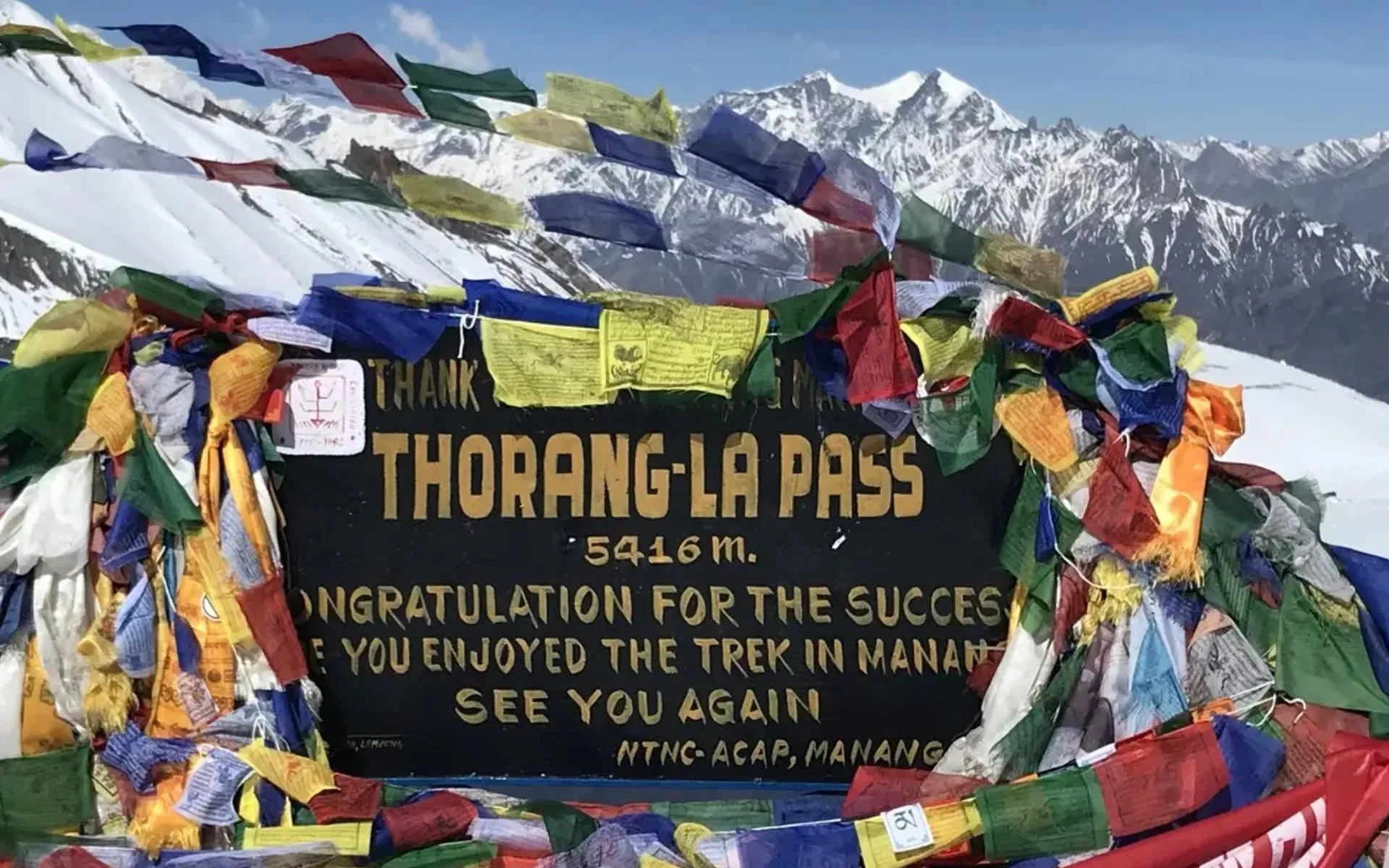
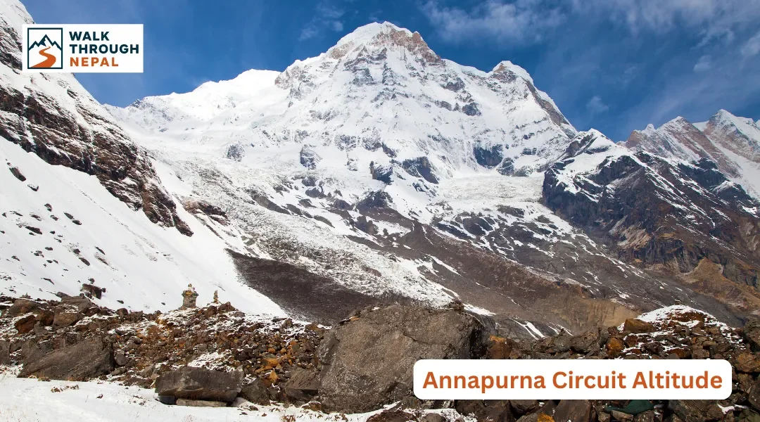
The Annapurna Circuit reaches a maximum altitude of 5,416 meters (17,769 feet) at Thorong La Pass. This is the highest point you physically reach, crossed on foot in a single morning. You never sleep at this height. Your highest overnight stop is Thorong Phedi at roughly 4,525 meters, nearly 900 meters lower.
The trek does not climb continuously. It follows the Marsyangdi valley upward for days, tops out at the pass, then drops sharply into the Kali Gandaki valley on the far side. That up-and-then-down shape is why the Circuit feels like two different treks joined at a high mountain saddle.
The gap between the highest altitude reached and the highest altitude slept at is the whole reason the standard itinerary works. Sleeping lower than your daily high point is the foundation of safe acclimatization. Altitude becomes a real consideration from Manang onward, and it dominates everything from Yak Kharka to the pass.
The Annapurna Circuit Altitude Profile
Picture the Circuit not as a map but as a line that rises steadily, spikes hard at the end of the climbing section, then plunges. The classic sequence runs Dharapani, Chame, Pisang, Manang, Yak Kharka, Thorong Phedi, over Thorong La, down to Muktinath, and out to Jomsom.
What matters is the shape of that curve, not the geography. The trail spends days below 3,000 meters, then grinds up through the high-altitude zone, and finally throws in one steep summit push before releasing all that height in a single descent day.
Below 3,000 meters — The Adjustment Zone
From Dharapani up to around Chame and lower Pisang, your body is adapting to increasing elevation. Most people feel fine here, though you may notice you breathe a little harder on climbs. The forest is still green and the air still feels thick.
3,000 to 4,000 meters — Altitude Starts to Matter
From upper Pisang into Manang, altitude becomes a genuine consideration. Oxygen availability drops noticeably, sleep can turn restless, and appetite may fade. This is where careful pacing and acclimatization days earn their place.
Above 4,000 meters — Thin Air
From Yak Kharka to Thorong Phedi and the pass, the air is significantly thinner. Every step slows. Simple tasks feel harder, and your walking rhythm needs to drop right down. This is the zone where AMS risk is highest.
Annapurna Circuit Elevation From Start to Summit
Rather than tracking the route geographically, it helps to follow the altitude as it climbs. Each band of elevation brings a different physical experience.
1,800–3,000 m — The Initial Ascent
Starting around Dharapani at 1,860 meters, the trail winds through Chame at 2,650 meters and on to Pisang near 3,300 meters. Vegetation shifts from subtropical forest to pine and juniper. You feel the first mild effects of altitude on the steeper climbs, but nothing alarming.
3,000–4,000 m — Entering High Altitude
Upper Pisang and Manang, at roughly 3,519 meters, sit firmly in high-altitude terrain. Oxygen is noticeably reduced, and your walking pace should already be slower than at home. Many trekkers first sense broken sleep and morning headaches here.
4,000–5,000 m — The Critical Altitude Zone
Yak Kharka at around 4,020 meters and Thorong Phedi at 4,525 meters mark the demanding upper section. Altitude exposure builds fast, and acclimatization matters more here than anywhere else on the trek. This is where slow, deliberate ascent protects you.
5,000 m+ — Thorong La
The pass stands at 5,416 meters (17,769 feet), the single high point of the journey. You reach it, take your photos in the cold wind, and immediately begin descending. For the full crossing detail, see our dedicated guide to the Thorong La Pass.
Annapurna Circuit Altitude Table
Here are the key elevations in one place. Remember that not every number below is a place you sleep, several are simply points you pass through.
Location | Approx. Elevation |
Dharapani | 1,860 m |
Chame | 2,650 m |
Upper Pisang | 3,300 m |
Manang | ~3,519 m |
Yak Kharka | ~4,020 m |
Thorong Phedi | ~4,525 m |
Thorong La Pass | 5,416 m |
Muktinath | ~3,800 m |
Jomsom | ~2,720 m |
For a full geographic breakdown of stops and stages, our Annapurna Circuit route map and elevation guide lays out the whole trail day by day.
Sleeping Altitude on the Annapurna Circuit
Sleeping altitude is the number that governs your acclimatization, and it is different from your daily high point. Above 3,000 meters, safe practice keeps sleeping-elevation increases to just 300 to 500 meters per day. That rule shapes the entire itinerary.
You reach 5,416 meters at the pass, but you sleep no higher than about 4,525 meters at Thorong Phedi. Climbing high and sleeping low is exactly what helps your body adapt.
Overnight Stop | Approx. Sleeping Elevation |
Dharapani | 1,860 m |
Chame | 2,650 m |
Upper Pisang | 3,300 m |
Manang | ~3,519 m |
Yak Kharka | ~4,020 m |
Thorong Phedi | ~4,525 m |
Muktinath | ~3,800 m |
Jomsom | ~2,720 m |
Notice the jump from Muktinath back down to Jomsom. Once you cross the pass, your sleeping altitude drops steadily, which is why the second half of the trek feels physically easier.
When Does Altitude Become a Concern on the Annapurna Circuit?
Altitude becomes a genuine concern above 3,000 meters, and the risk rises with both how high you go and how fast you climb. Fitness does not make you immune. The zone from Manang up to Thorong La demands slow pacing, steady hydration, and honest symptom monitoring every single day.
Around 3,000 m
You may notice shortness of breath on climbs and lighter, more interrupted sleep. This is normal, but it is the signal to slow your ascent rate.
Around 4,000 m
The trek feels distinctly different. Walking speed drops, small efforts feel large, and headaches or reduced appetite are common. Days become shorter in distance but heavier in effort.
Above 5,000 m
Thorong La is physically demanding because oxygen is roughly half of what you breathe at sea level. Even strong trekkers move slowly here. This is not a place to push through discomfort.
8-Day Ghorepani Poon Hill Trek Package – Cost, Itinerary & Guide
Manaslu Circuit Trek Packages – Cost, Permit & 12, 14 or 16 Day Options
Upper Mustang Trek Packages – Cost, Permit & 14 or 16 Day Options
Everest Base Camp Trek Packages – Cost, Itinerary & 12, 14 & 16 Day Options
How Does Your Body React to Annapurna Circuit Altitude?
At altitude, most people notice heavier breathing during exertion, faster fatigue, mild headaches, a drop in appetite, difficulty sleeping, and a naturally slower walking pace. These mild symptoms are common and usually manageable with rest and hydration.
What you must not ignore are worsening symptoms: a severe headache that painkillers do not touch, vomiting, confusion, loss of coordination, or breathlessness at rest. These can signal serious altitude illness. The correct response is to descend and seek professional medical help, not to continue upward. We always recommend consulting a doctor before your trek about altitude medication and your personal risk.
Why Manang Is Important for Altitude Acclimatization
Manang, at roughly 3,519 meters, is the acclimatization heart of the Annapurna Circuit. Rather than pushing straight for the pass, trekkers pause here for an extra day. The proven method is to hike higher during the day, then return to sleep at Manang's lower elevation.
A popular acclimatization hike climbs toward Ice Lake, gaining significant height before descending back to the village. That climb-high, sleep-low pattern trains your body for the thin air ahead. Skipping Manang's rest day is one of the most common reasons trekkers struggle later. For a wider look at the physical demands, read our Annapurna Circuit difficulty guide.
How Much Elevation Do You Gain on the Annapurna Circuit?
There is no single tidy number for total ascent, because the daily gain changes dramatically. Early days below 3,000 meters add height gently, while the climbing tightens sharply after Manang. The most significant single push is Thorong Phedi to Thorong La.
Consider the key milestones: Dharapani at 1,860 m, Manang at 3,519 m, Thorong Phedi at 4,525 m, and Thorong La at 5,416 m. From Phedi to the pass alone you gain nearly 900 meters in a single morning at extreme altitude, which is why that day starts before dawn and demands full acclimatization.
Why Does Thorong La Feel So Difficult Despite the Descent After It?
Thorong La is punishing because you reach it after days of steadily thinning air, and oxygen at 5,416 meters is roughly half of sea level. The crossing begins in the cold dark, usually before sunrise, to beat the strong afternoon winds. Weather at the top can turn quickly.
Reaching the pass is only half the story. After the summit you still face a long, knee-testing descent of over 1,600 meters down to Muktinath. That combination of altitude, early start, and a huge downhill makes this the hardest day of the entire trek. Prepare with the right footwear and layers from our Annapurna Circuit packing list.
Annapurna Circuit Altitude After Thorong La
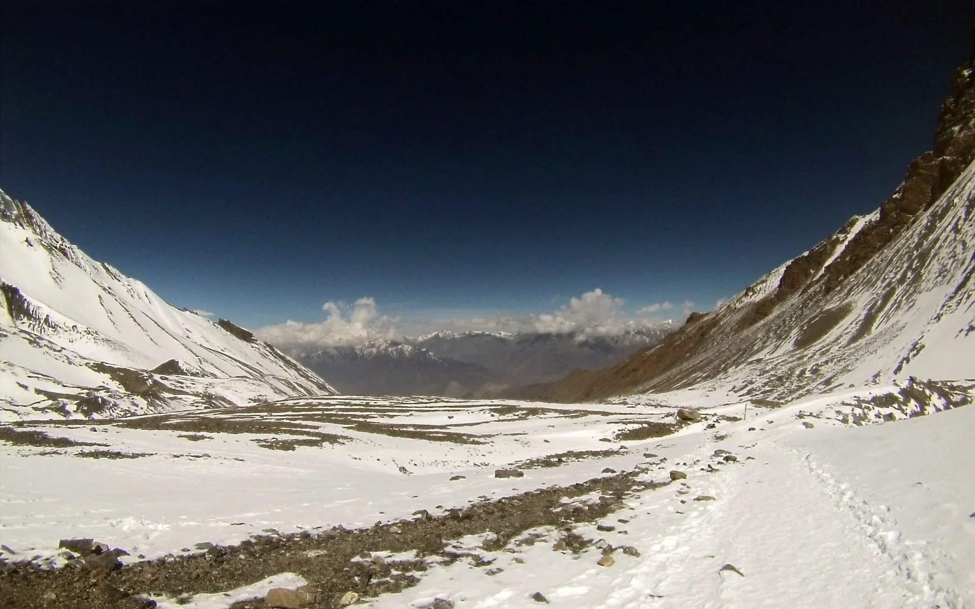
The highest point is not the end of the altitude challenge, but it is the turning point where things ease. From Thorong La at 5,416 m, you descend to Muktinath at around 3,800 m, then continue down to Jomsom at roughly 2,720 m.
That steep drop transforms the experience. The landscape opens into the dry, wind-carved Kali Gandaki valley, and most trekkers immediately notice easier breathing and returning appetite as they lose elevation. The second half of the trek trades altitude stress for dramatic desert scenery.
Does Fitness Help With Annapurna Circuit Altitude?
Fitness helps you cope with the daily walking workload, but it does not prevent altitude sickness. Strong, well-trained trekkers still develop AMS if they climb too fast. Acclimatization, not muscle, is the real protection at altitude.
Good cardiovascular fitness, endurance, practice on consecutive walking days, and disciplined pacing all make the trek more enjoyable and help your recovery each evening. But no amount of gym work substitutes for gradual ascent. Treat fitness as comfort insurance, not altitude insurance.
How to Prepare for the Altitude
Before the trek: Build endurance with long walks, practice steep uphill climbs, and get used to walking several days in a row so your body knows what to expect.
During the trek: Ascend gradually, respecting the 300 to 500 meters per day sleeping-gain rule above 3,000m. Follow the acclimatization plan, take the Manang rest day, resist the urge to rush, drink plenty of water, and monitor your symptoms honestly each day.
If you feel unwell: Never treat worsening altitude symptoms as something to push through. Descending and seeking medical help may be necessary and could save your life. We strongly advise carrying travel insurance that specifically covers high-altitude helicopter evacuation up to 6,000 meters and treatment for AMS, HAPE, and HACE. Standard policies rarely include this.
Annapurna Circuit Altitude vs Annapurna Base Camp
These two Annapurna treks sit in very different altitude leagues. The Circuit goes considerably higher and carries the tougher altitude challenge.
Factor | Annapurna Circuit | Annapurna Base Camp |
Highest point | 5,416 m | ~4,130 m |
Highest point reached | Thorong La | Annapurna Base Camp |
Main altitude challenge | Thorong La crossing | ABC approach |
Overall altitude | Higher | Lower |
If the Circuit's altitude gives you pause, the shorter ABC trek is a gentler introduction to Himalayan trekking. Explore our detailed Annapurna Base Camp altitude guide and ABC difficulty breakdown to compare.
A Few Practical Notes for the Trail
Come prepared for the trail micro-economy. ATMs disappear once you head deep into the valley, so carry enough NPR cash for the whole trek. Expect small upcharges of 200 to 700 NPR for charging devices, gas-heated hot showers, and Wi-Fi at higher lodges. For connectivity, Ncell gives the strongest coverage across the Annapurna Circuit.
Eat smart at altitude. We recommend prioritizing fresh, local carbohydrates, and the classic Dal Bhat is your best fuel with free refills. Skip plastic bottled water to protect the region; instead carry a reusable bottle with a UV purifier, Sawyer filter, or chlorine dioxide drops. And when you pass mani walls and chortens, always walk clockwise, keeping them on your right.
Ready to Trek Nepal?
Understanding the altitude is the first real step toward crossing Thorong La safely and enjoying every day of the Annapurna Circuit. If you would like a properly paced, acclimatization-focused itinerary, our team can connect you with verified, licensed local guides who know this trail intimately. Browse tailored Annapurna Circuit itineraries on our platform and reach out anytime to plan your route around your own fitness and schedule. Contact us now.
Frequently Asked Question
1. What is the highest altitude on the Annapurna Circuit?
The highest point on the Annapurna Circuit is Thorong La Pass at 5,416 meters (17,769 feet). This is the altitude you reach on foot during the day, not where you sleep. The highest overnight stop is Thorong Phedi at roughly 4,525 meters.
2. How high is Thorong La Pass?
Thorong La Pass sits at 5,416 meters (17,769 feet). It is one of the highest trekking passes in the world and marks the physical high point of the entire Annapurna Circuit before the long descent toward Muktinath.
3. What is the altitude of Manang?
Manang village sits at approximately 3,519 meters. It is the key acclimatization stop on the Annapurna Circuit, where most trekkers spend an extra day before continuing higher toward Thorong La.
4. What is the altitude of Thorong Phedi?
Thorong Phedi sits at approximately 4,525 meters. It is the last major overnight stop before the Thorong La crossing and represents the highest sleeping altitude for most trekkers on the circuit.
5. What is the sleeping altitude on the Annapurna Circuit?
Sleeping altitude progresses from around 1,860m at Dharapani to a maximum of roughly 4,525m at Thorong Phedi. Although you reach 5,416m at Thorong La during the day, you never sleep at that height.
6. How quickly does the Annapurna Circuit gain altitude?
Gain is gradual in the lower valley but tightens above 3,000m, where safe practice limits sleeping-elevation increases to 300-500m per day. The largest single climb is the roughly 900m push from Thorong Phedi to Thorong La.
7. At what altitude does altitude sickness become a concern?
Altitude sickness becomes a genuine concern above 3,000 meters. Risk rises with both absolute altitude and ascent rate, so the zone from Manang upward requires slow pacing, hydration, and careful symptom monitoring.
8. Is Annapurna Circuit altitude harder than ABC?
Yes. The Annapurna Circuit peaks at 5,416m on Thorong La, while Annapurna Base Camp tops out around 4,130m. The Circuit involves a higher, more demanding altitude challenge overall.
9. Does fitness help with altitude?
Fitness helps you handle the daily walking workload but does not prevent altitude sickness. Even very fit trekkers can develop AMS if they ascend too quickly. Gradual acclimatization matters far more than raw fitness.
10. How do you acclimatize on the Annapurna Circuit?
Acclimatize by ascending gradually, keeping sleeping-elevation gains to 300-500m per day above 3,000m, and taking a rest day at Manang with a hike to a higher point such as Ice Lake before returning to sleep lower.
11. What is the highest sleeping point on the Annapurna Circuit?
The highest sleeping point is Thorong Phedi at roughly 4,525 meters, or High Camp slightly above it. Trekkers cross the 5,416m Thorong La the next morning but descend to sleep at Muktinath around 3,800m.
12. How much does the altitude drop after Thorong La?
After the 5,416m Thorong La, the trail descends steeply to Muktinath at around 3,800m, a drop of over 1,600m in a single day, then continues down to Jomsom at roughly 2,720m.