Contents
The Annapurna Circuit is one of the few treks in Nepal where you can start in warm, humid rice terraces and finish crossing a snow-dusted pass higher than any peak in the Alps. That range is exactly why weather questions matter so much here. What you experience on day two in Dharapani has almost nothing in common with what you'll face on your Thorong La crossing morning.
We've coordinated Annapurna Circuit departures across every season, and the single biggest planning mistake we see is travelers treating the trek as if it has one weather pattern. It doesn't. Let's break it down properly.
What Is the Weather Like on the Annapurna Circuit?
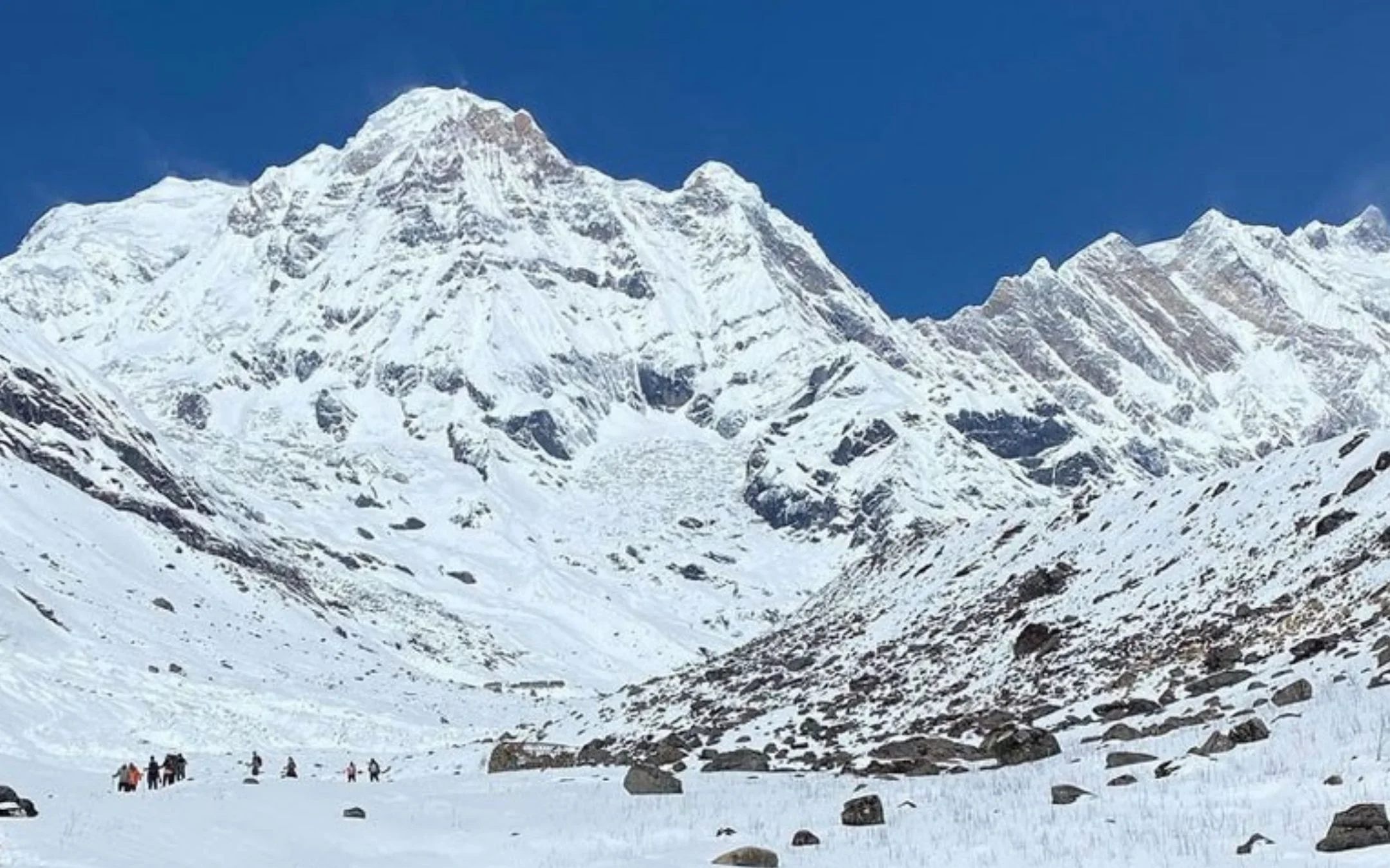
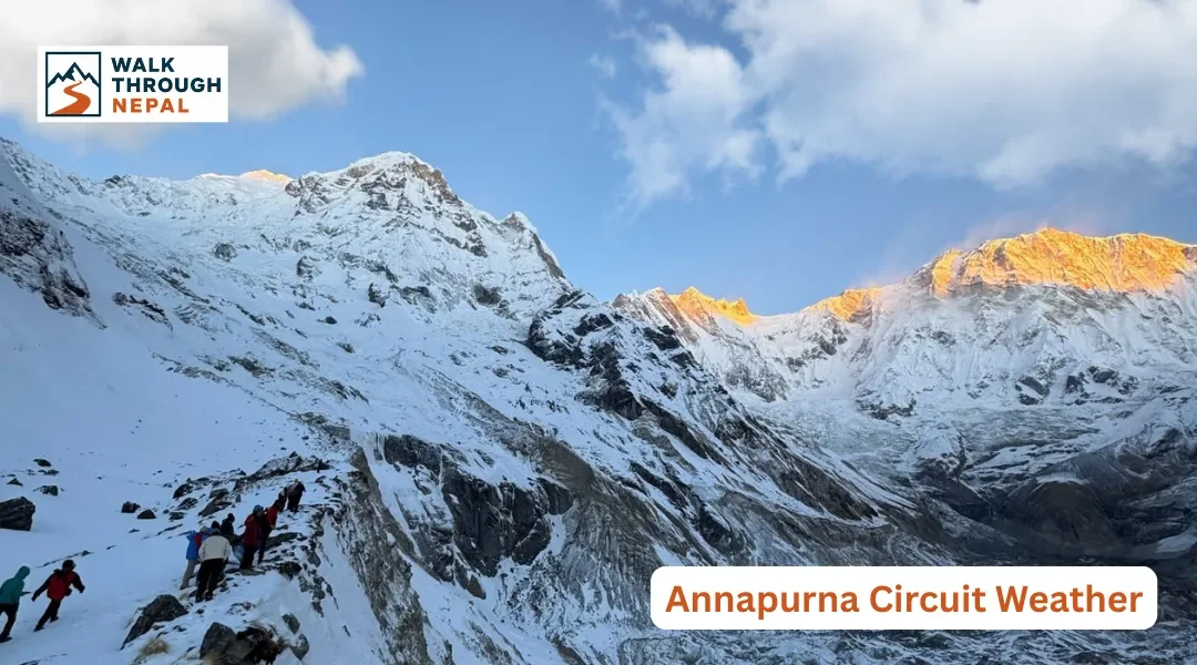
Weather on the Annapurna Circuit varies dramatically by elevation and season. The route climbs from warm subtropical valleys through mid-mountain forests into cold high-alpine terrain, then drops into the dry, wind-scoured Mustang landscape. The high point, Thorong La at 5,416 meters, is cold and unpredictable year-round.
Because the trail passes through several distinct climate zones, there is no single "Annapurna Circuit weather." A comfortable afternoon in Chame can coincide with a snowstorm near Thorong Phedi on the same day. Understanding this vertical spread is the key to packing and timing your trek correctly. You can review the full climb profile in our Annapurna Circuit altitude guide.
Annapurna Circuit Weather at a Glance
Spring and autumn are the strongest seasons for the circuit, delivering stable skies and clear mountain views. Winter and monsoon are both trekkable with the right preparation, but each brings specific challenges you need to plan around before committing.
Season | Months | General Conditions | Trekking Outlook |
Spring | March–May | Mild, increasingly warm, generally clear | Excellent |
Monsoon | June–August | Wet lower sections, relatively dry upper circuit | Mixed |
Autumn | September–November | Clear, dry and stable | Excellent |
Winter | December–February | Very cold, snow at higher elevations | Challenging |
Annapurna Circuit Weather by Elevation
Elevation, not the calendar, is the biggest driver of the weather you'll actually feel. On any given day you may walk through several climate zones. Below we break the circuit into its main altitude bands so you can picture the real conditions section by section.
Lower Elevations: Dharapani and Below
The lower Marsyangdi Valley is warm, humid, and green. Daytime walking here can feel muggy, and this is the section most affected by rain during the monsoon months. Expect subtropical vegetation, waterfalls, and terraced farmland.
During June to August, these lower trails turn muddy and slippery, and leeches appear in the forest sections. This is also where jeep roads share the valley, so we recommend the NATT (New Annapurna Trekking Trails) walking paths to avoid dust and vehicle traffic wherever possible.
Middle Elevations: Chame to Manang
From roughly Chame upward, temperatures cool noticeably and the day-to-night swing widens. As you approach Manang you enter the edge of the rain-shadow zone, so rainfall drops off even during the wet season. Pine forests give way to a more alpine, open landscape.
Manang at around 3,540 meters is the standard acclimatization base, and for good reason. Nights here are cold across all seasons, and you'll want a warm layer even on clear spring afternoons.
High Elevations: Yak Kharka to Thorong Phedi
Above Manang, weather turns serious. Mornings and nights are cold, winds strengthen, and snow is possible in any season. Weather can shift rapidly, and there's little shelter from exposure on these high sections between Yak Kharka and Thorong Phedi (High Camp).
This is where our safety rules tighten. Above 3,000 meters, sleeping elevation should not increase more than 300 to 500 meters per day, with a mandatory acclimatization rest day in Manang. Rushing this stretch is the fastest route to altitude sickness.
Thorong La Pass
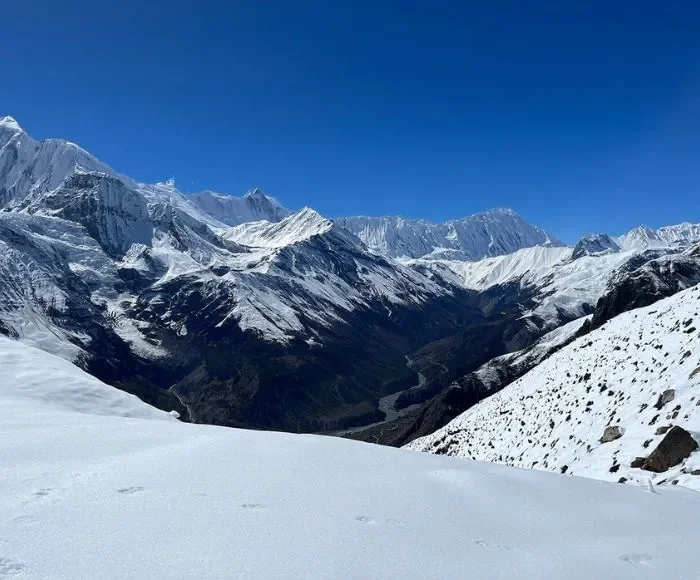
The weather at Thorong La (5,416 meters) matters far more than conditions lower down. Wind, cold, snow, ice, and poor visibility all peak here, and they can change within an hour. This is why crossings start extremely early, usually between 3:00 AM and 4:00 AM, when winds are calmest and snow is still firm.
Afternoon weather on the pass is notoriously worse than the morning, with rising wind and cloud.
Mustang Side: Muktinath to Jomsom
Descending the western side into the Mustang region, the climate flips to dry and arid. This is true rain-shadow country: brown hills, big skies, and very little precipitation. The trade-off is wind.
The Kali Gandaki corridor between Muktinath and Jomsom is one of the windiest valleys in the world, and gusts pick up sharply from late morning onward. We advise trekkers to walk this section early to avoid battling wind and blowing dust in the afternoon.
Annapurna Circuit Weather by Season
Each season has its own personality on the circuit. Below we explain not just what to expect, but how conditions shift within each season, because early spring and late spring can feel like two different trips.
Spring Weather — March to May
Spring conditions improve steadily. March still holds winter's chill, and higher elevations near Thorong La can carry lingering snow and ice early in the month. April is the sweet spot, with mild days, stable skies, and hillsides of blooming rhododendron across the lower and middle sections.
By late May, pre-monsoon heat builds and afternoon clouds become more frequent, softening mountain visibility. So spring isn't uniformly "perfect" — early spring is cold and snowy up high, while late spring turns hazy and warm down low.
Monsoon Weather — June to August
This is the most misunderstood season, and one of the most interesting for experienced trekkers. The lower Marsyangdi Valley gets genuinely heavy rain, mud, slippery trails, landslide risk, and occasional road disruption. But the upper circuit is a completely different story.
Why Is the Annapurna Circuit Drier During Monsoon?
Manang, Yak Kharka, Thorong Phedi, and Muktinath sit behind tall Himalayan ranges that block most of the monsoon clouds pushing up from the south. This rain-shadow effect leaves the upper valleys far drier than the lower sections. The same principle makes Upper Mustang and Upper Dolpo premier summer trekking destinations while the rest of Nepal is soaked.
So the honest answer to "can you trek the circuit in monsoon?" is yes, if you accept a wet, leech-prone lower approach in exchange for a surprisingly dry upper route.
Autumn Weather — September to November
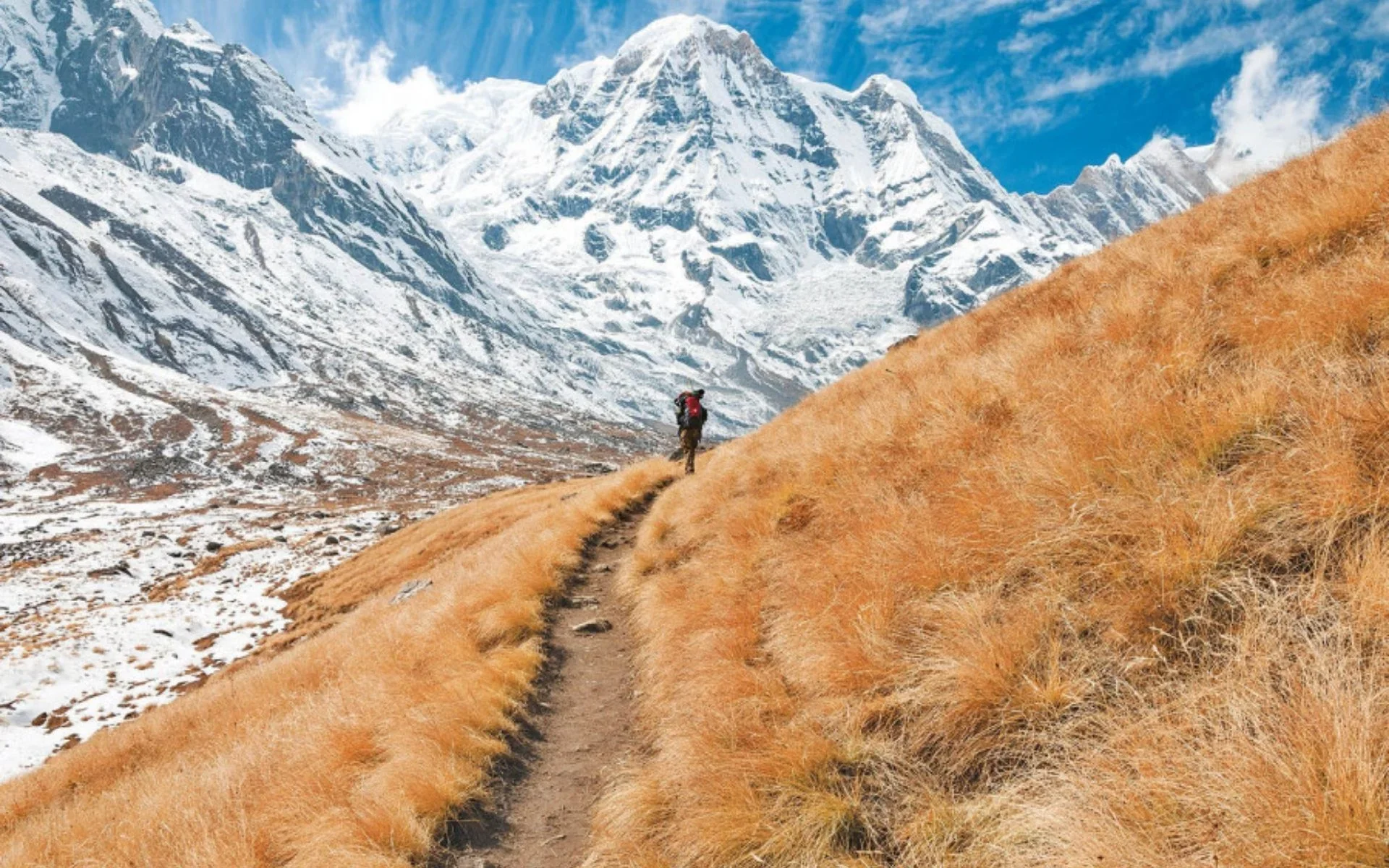
Autumn is widely regarded as the best window on the circuit, with post-monsoon skies producing exceptionally clear mountain views. September still carries the tail end of the monsoon, with possible rain early in the month, but conditions clear steadily.
October delivers stable weather, crisp visibility, and comfortable daytime temperatures — this is peak season, so trails and lodges are busy. November brings very clear skies but colder nights, and winter conditions start creeping into the high sections toward month's end. If clear Himalayan panoramas are your priority, October and early November are hard to beat.
Winter Weather — December to February
Winter is not simply "bad" — it's a trade-off. The rewards are clear skies, snow-draped peaks, empty trails, and beautiful frozen landscapes. The challenges are real cold, snow at altitude, and genuine risk of pass closure.
January and February can bring temperatures far below freezing at high elevations, and heavy snowfall can make Thorong La impassable or dangerous. Daylight is shorter, and some high-altitude lodges reduce services or close entirely. Winter is possible for well-equipped, experienced trekkers with a licensed guide and flexible plans, but it demands serious respect for the conditions.
Annapurna Circuit Weather Month by Month
Use this table as your quick monthly reference. It combines general valley weather, high-altitude conditions, and trail state so you can match your dates to your comfort level.
Month | Weather | High-Altitude Conditions | Trail Conditions |
January | Very cold | Snow/ice possible | Difficult |
February | Cold | Winter conditions | Snow possible |
March | Warming | Snow may remain | Improving |
April | Mild/stable | Cold at night | Excellent |
May | Warmer | Increasing clouds | Good |
June | Increasing rain | Upper route drier | Wet lower sections |
July | Heavy monsoon | Upper circuit relatively dry | Mud/landslide risk |
August | Wet | Rain shadow helps upper route | Wet lower sections |
September | Improving | Clearing conditions | Improving |
October | Stable/clear | Cold at high altitude | Excellent |
November | Clear/cool | Increasing cold | Good early |
December | Cold | Snow possible | Challenging |
Annapurna Circuit Temperature by Month
There is no single temperature for the whole circuit, because low and high sections differ enormously on the same day. A warm afternoon in the valley can coincide with sub-zero cold near Thorong Phedi. Rather than quote misleading precise numbers, we compare typical ranges by elevation band and season below.
Season | Lower Elevations | High Elevations |
Spring | Mild to warm | Cold, especially at night |
Monsoon | Warm/wet | Cool to cold |
Autumn | Mild | Cold at night |
Winter | Cool/cold | Often below freezing |
The practical takeaway: pack for two climates at once. You'll want light, breathable layers for the valleys and a proper insulated system for the high camps.
How Weather Changes During the Day
Daily weather rhythm is remarkably consistent on the circuit, and it explains a lot about why trekking days are structured the way they are. Mornings are typically cooler with the best visibility, which is exactly why high-pass crossings begin before dawn.
By midday, lower elevations warm up while exposed high sections start to catch wind. Afternoons often see clouds building, wind strengthening, and — depending on season — showers developing. After sunset, temperatures at altitude drop fast. This is why we always push high-altitude walking into the early hours and aim to be settled in a teahouse well before the afternoon weather turns.
Does Weather Affect the Thorong La Crossing?
Weather is the single biggest factor in a safe Thorong La crossing. Snow, strong wind, ice, poor visibility, and heavy precipitation can all turn a manageable pass into a dangerous one. Fresh snow raises avalanche and route-finding concerns, while whiteout visibility makes navigation risky.
This is precisely why crossings start so early and why we build buffer flexibility into the schedule. If conditions look severe, the correct decision is to wait a day rather than push through. Read our full Thorong La Pass guide for the crossing playbook, and check the difficulty guide to understand how weather compounds the physical challenge.
Does Monsoon Affect the Entire Annapurna Circuit?
No. The lower Marsyangdi Valley receives heavy monsoon rain, but Manang and the upper circuit sit in a rain shadow and stay much drier. The Mustang side beyond Thorong La is drier still. So monsoon impact depends entirely on which part of the circuit you're standing in.
This uneven pattern is why some experienced trekkers deliberately plan summer departures around the upper, drier sections. It's a nuanced call, and we recommend reviewing your full route on the route map and elevation guide before deciding.
What Weather Conditions Can Disrupt the Annapurna Circuit?
A few specific weather events cause most real disruptions. Heavy rain brings mud, landslides, and road closures on the lower approach. Heavy snow can block trails and make the Thorong La crossing impossible. Strong wind — particularly around exposed high sections and the Kali Gandaki corridor — slows progress and reduces comfort.
Poor visibility affects both navigation and mountain views, and sudden weather shifts at altitude can catch trekkers off guard. Building 1 to 2 buffer days into your itinerary is the simplest insurance against all of these.
What Should You Pack for Annapurna Circuit Weather?
Pack for a full spectrum of conditions in a single trek. At minimum, plan for a waterproof shell, warm insulating layers, a down or synthetic jacket, gloves, a warm hat, trekking trousers, sun protection, waterproof footwear, sunglasses, and a season-appropriate sleeping bag.
The high sections demand serious warmth even in autumn, while the valleys call for lightweight, breathable clothing.
A note on trail logistics: carry enough Nepalese Rupees in cash, since ATMs disappear once you leave the roadhead. Expect extra charges of roughly NPR 200 to 700 for charging devices, gas-heated hot showers, and Wi-Fi at teahouses. On connectivity, Ncell gives reliable coverage across much of the Annapurna Circuit, though signal thins out at the highest camps. If you want a full packing list, here’s our Annapurna Circuit packing list that breaks this down item by item.
Which Season Is Best for Annapurna Circuit Weather?
The best overall window is October to November, combining stable weather with the clearest mountain visibility of the year. March to April is an excellent alternative, offering good conditions and spring rhododendron landscapes.
June to August is possible with planning, since the upper circuit lies in the rain shadow, but the lower sections can be genuinely difficult in the rain. January to February is the most challenging period, defined by extreme cold and the risk of snow closing Thorong La.
Plan Your Annapurna Circuit Trek Around the Weather
Let your priorities pick your season. Want stable weather and clear views? Choose October or November. Prefer spring scenery and blooming hillsides? Go in March or April. Want quiet trails and don't mind the cold? Winter works with careful planning and a licensed guide.
Considering monsoon? Understand the difference between the wet lower valley and the dry upper circuit before you commit. Whatever your window, having proper insurance that covers high-altitude helicopter evacuation up to 6,000 meters is non-negotiable, and a licensed guide keeps you safe when the weather turns.
Ready to explore the Annapurna Circuit? Walk Through Nepal can help you choose the right season, arrange permits, provide experienced guides, and plan a trek that matches your schedule, budget, and trekking goals. Contact our team to start planning your adventure.
FAQs
1. What is the weather like on the Annapurna Circuit?
Weather on the Annapurna Circuit changes dramatically by elevation. Lower valleys are warm and humid, mid-mountain zones are cool and alpine, and the high sections near Thorong La at 5,416 meters are cold, windy, and prone to snow. There is no single circuit-wide weather pattern.
2. What is the best month for Annapurna Circuit weather?
October is widely regarded as the best month, offering stable, dry conditions and the clearest mountain visibility. April is the strongest spring alternative with mild temperatures and rhododendron blooms.
3. Can you trek the Annapurna Circuit during monsoon?
Yes, but with careful planning. The lower Marsyangdi Valley receives heavy rain, mud, and landslide risk, while the upper circuit around Manang, Yak Kharka, and Muktinath sits in the Himalayan rain shadow and stays significantly drier.
4. How cold is Thorong La Pass?
At 5,416 meters, Thorong La can drop well below freezing on early-morning crossings, especially in winter. Strong winds, snow, and ice can make conditions serious, and heavy snowfall may close the pass entirely.
5. Why is Manang drier during monsoon?
Manang and the upper circuit lie behind high Himalayan ranges that block most monsoon clouds moving up from the south. This rain-shadow effect keeps the upper valleys far drier than the lower southern sections during June to August.